


Home for a decade, and more diverse than many would give her credit for, Botswana has plenty of tricks up her sleeve.
From salt pans the size of Switzerland, to the oasis that is the Okavango Delta - adrift on a sea of Kalahari sands.
In Botswana, some of the best spots are still waiting to be mapped, and getting away from the crowds is as easy as taking the next track.
Although known for offering spectacular safaris, Botswana is so much more than wildlife, if you’re prepared to take the time to stay a little longer to find out.
Contact me for prints or image licencing
Sitting adrift at the edge of the Makgadikgadi Salt Pans, Kubu Island appears like a mirage on the horizon - littered with boulders and baobabs
Given the Makgadikgadi Salt Pans are roughly the same size as Switzerland, it’s little wonder geographical features out here get lost from time to time.
This island in the middle of the Makgadikgadi is one such spot. Pinned on a mental map by Jack Bousfield (after whom Jack’s Camp is named) this spot was lost for years after his death.
The island was only re-discovered (and GPSed) more recently, and is absent from any official maps.
Before the waters of the Okavango Delta spread out into the floodplains which form its alluvial fan, they wind their way through permanent, papyrus lined channels like this one to reach their destination.
Cruising through these channels on a speedboat, the stands of papyrus stretch far overhead, easily capable of hiding a giant elephant bull from view.
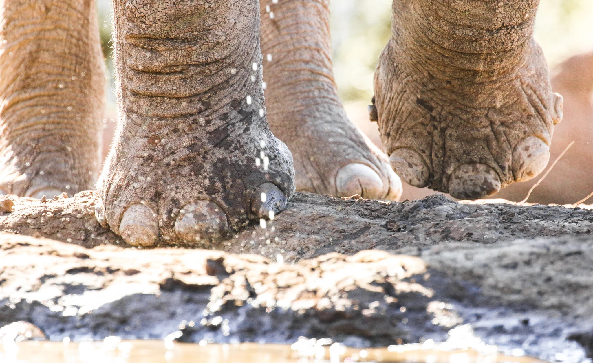
Sometimes you think you’ve seen everything - when you’ve actually just kept staring from the same perspective.
Getting into an underground hide, such as those available at Mashatu or Hyena Pan will make it a whole lot easier to count an elephant’s toes, without risk of being trodden on.
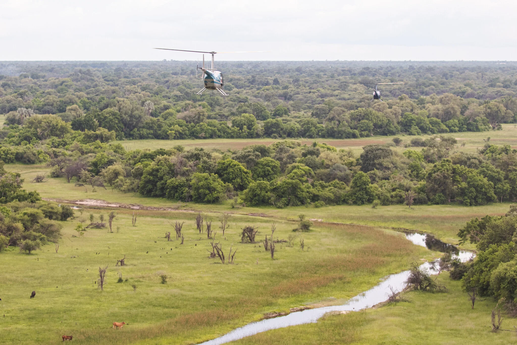
Getting above the Okavango Delta in a helicopter will change your perspective on the landscape immediately.
High up above the floodplains, looking down on the wildlife from above, you’ll get a bird’s-eye perspective of the bush below.
The Okavango Delta is a favourite retirement village for old elephant bulls.
With lots of soft reeds and grasses available for eating, the delta provides easy food for ageing teeth, and spotting old elephants amongst the channels is a common occurrence.
The Chobe River forms the international boundary between Botswana and Namibia.
Although the Botswana side of the river is mostly national park, on the Namibian side of the river, there are plenty of fishing villages in the floodplains, where communities rely on subsistence fishing for their livelihoods.
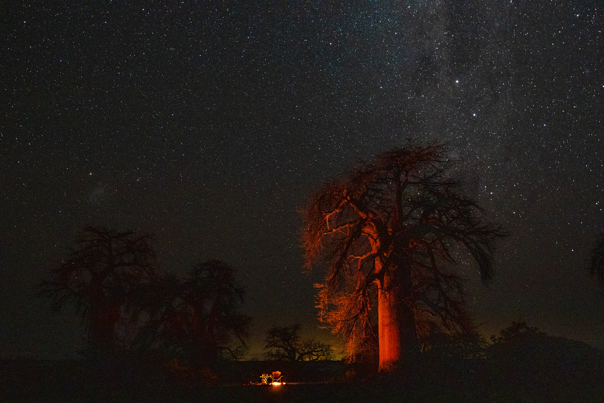
In the vastness of the Makgadikgadi, the bedroom curtains are stitched out of stars, and the shade at high noon woven from 2000 year-old baobab branches.
Best of all, due to the sheer size and remoteness of the pans, it’s easy to find a secluded spot for a solo sleep out with no one else around.
West of the Okavango Panhandle lies the village of Xai Xai, home to a small population of khoi san minority.
Famed for being one of the planet’s remaining hunter-gatherer cultures, the khoi san of Xai Xai can often be seen sporting Chinese footwear, fast fashion and multiple mobile phones, rather than traditional wear as seen in this shot.
This elder was out at Aha Hills, enjoying a smoke from an old bullet cartridge turned pipe, after a night of trance dancing, having dressed in traditional duiker skins for the occasion.
Africa’s longest mammal migration takes place twice a year in Botswana. Part of this massive movement of zebra and wildebeest takes place between the Boteti River and the Makgadikgadi Salt Pans.
In this shot, two zebra are moving from the Boteti River and out into the freshly water-covered pans (as seen in this image) where they will spend the rainy season until the surface water dries once more.
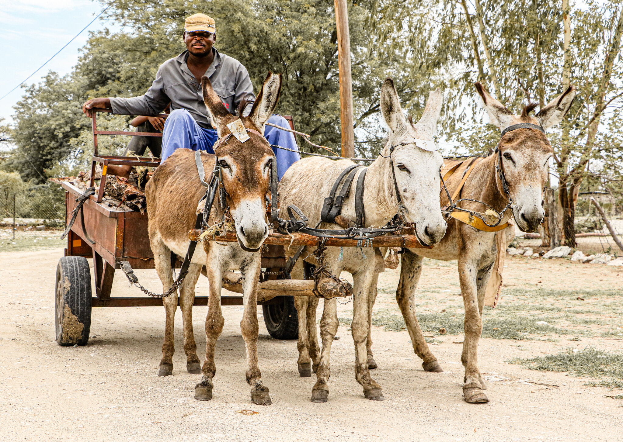
In many parts of Botswana, donkeys are the more reliable workhorses for transporting goods, from firewood to oil drums.
This shot was taken in the rural village of Gweta, which serves as a logistical gateway to the Magkadikgadi Salt Pans, and a stopover between Maun and Nata.
The Boro River is the main waterway which brings water from the Okavango Delta into ‘dusty donkey town Maun’ as it’s affectionately known to those in the safari industry.
In peak water, the narrow channel in this shot floods, spreading out to cover the floodplain and engulf the tree line in good years. This shot was taken during green season, just south of the ‘buffalo fence’ which separates domestic livestock (as seen in this shot) from the Okavango Delta’s wildlife.
A springbok crosses the tracks of the Central Kalahari Game Reserve after a recent downpour in the desert.
Sunsets over the Chobe River and Sedudu Island during the green season, at the boundary between the Chobe National Park and Kasane Town.
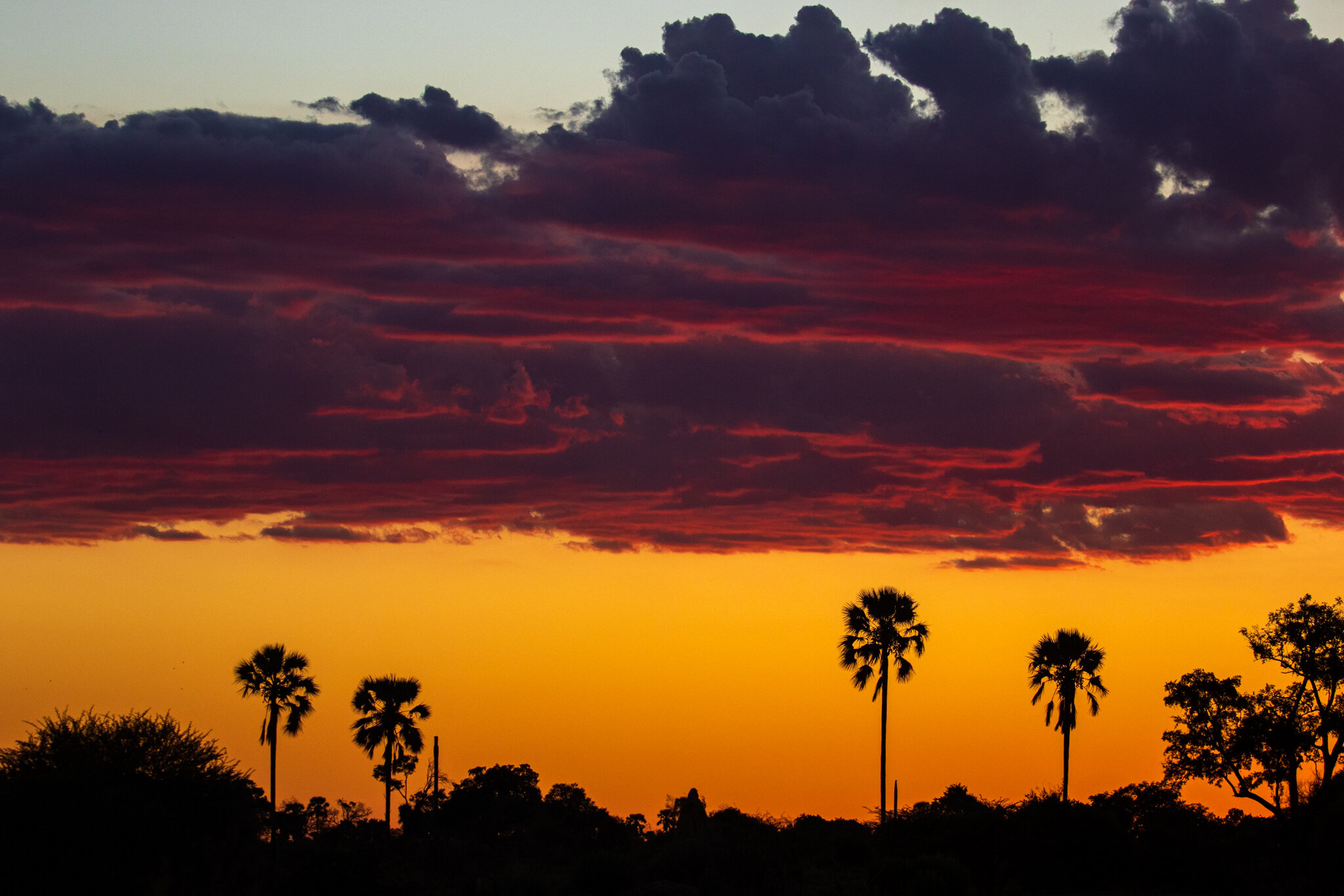
Most foreigners visiting Botswana can’t understand why anyone would get excited about the rainy season. Until they visit at this time of year.
For a country that only sees cloud cover (usually) between November and March, and where the rainclouds create sunsets as luminescent as this, it’s easy to understand why the words for ‘cheers’ and ‘rain’ are the same in Setswana: pula
On the banks of the Boteti River in winter, there’s little to no grass left poking from the sand. The dry conditions give rise to massive clouds of dust, which get kicked up as the resident zebras come to the water to drink at sunset, creating dramatic shapes in the light.
Not too far from the Makgadikgadi’s Kubu Island, there are other little rocky outcrops bursting with boulders and baobabs waiting to be discovered - if you don’t sink into the pan first while trying to get out there.
The newest batch of Makgadikgadi meerkats gets up to mischief by the edge of the salt pans.
With Botswana hosting a third of Africa’s remaining elephant population, it’s little wonder to expect you’d see a few while you’re travelling here.
Of Botswana’s 130,000 strong elephant population, the greatest concentration of these rambunctious characters is along the Chobe River, where counting them off is easy against the open landscape.
During the rainy season, it’s not uncommon to spot several rainclouds bucketing down at once, while standing out in the open and remaining quite dry (for now).
Flying in the green season comes with the challenge of weaving between rainclouds to avoid getting caught in the stormiest parts of the sky.
Botswana has several different ethnic groups, or tribes, despite often being typecast by the khoi san alone.
In Gweta Village, the predominant culture is that of the Bakalanga who are on occasion known for taking bright paintbrushes to their village compounds.
In the rainy season, the Central Kalahari comes alive in bursts of wildflowers. With the extra rain, the landscape turns from many shades of gold and brown, to lush greens interrupted with colour.
A lone wildebeest stands dwarfed against the horizon at Ntwetwe Pan, where grasslands and grazing meet the barren salt pan
Although Botswana is not known for having many hills, the Northern Tuli Game Reserve is one part of the country where they occur in abundance.
On top of this outcrop sits Rhodes’ Baobab, on a rocky base favoured by elephant shrews who bounce between the boulders at sunset.
The Chobe River is often referred to as ‘congested’ or ‘busy’
Usually, the term is only applied comparatively, as a way to explain that there’s more traffic here than in more remote corners of the country.
In high season, there are often several boats to be seen at sunset on this stretch of the water, though in the low season, the river can often sit empty - as seen here.
Botswana’s northern town of Maun is often considered to be the ‘gateway to the Okavango Delta’. Home to about 50,000 residents, Maun is situated along the Boro River, one of the Okavango Delta’s tributaries.
As the Boro is fed by the Okavango Delta, rising and dropping water levels can play havoc with the town’s water supply - particularly during the green season when river levels drop. It’s not uncommon to see residents heading up river with a few empty drums to fill with water from the river when the taps dry up.