


Three mountain ranges collide in Northern Pakistan, bursting so many mountains above 6000 metres into the air, that most haven’t even been named yet.
Pakistan is home to five of the planet’s 14 mountains above 8000 metres, and more than a hundred over 7000 metres.
To put that in perspective, only one of the “7 summits” that form the tallest mountains on each continent sits above 7000 metres: Everest.
Not only do the Karakorum, Hindu Kush and Himalaya mountains all converge here, but so too do many paths of human history along the scattered petroglyphs of the ancient silk road.
While modern-day politics may have stemmed the flow of people through this part of Pakistan since, there’s plenty to discover, from endless glaciers, to mountain peaks and swift flowing rivers running beneath the gaze of cliff-top forts.
Wedged up near international borders with China and Afghanistan, this part of Pakistan offers incredible colours during autumnal hikes
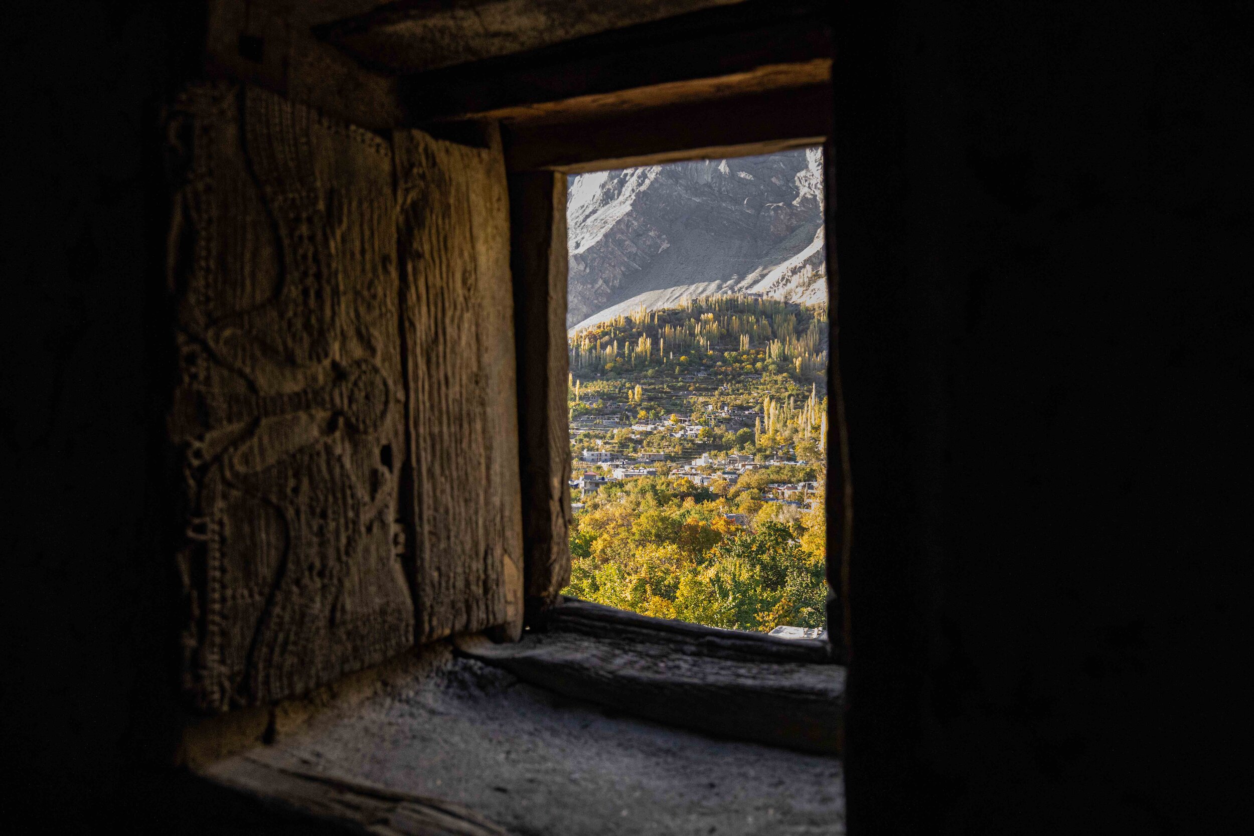
Northern Pakistan plays host to a number of old wooden forts overlooking the Hunza Valley and the surrounding Karakorum Mountains
Crossing the Husseni Suspension Bridge in Northern Pakistan may seem nerve-wracking at first, until you meet bridges in a far worse state of repair, such as the Passu Suspension Bridge a few hours hike away
daylight breaks through the 6am frost on the road from Hunza to Chitral
One of the world’s highest paragliding launching points, with the Himalaya in the background and the Booni plateau laid out as the perfect landing site in the foreground
Driving across northern Pakistan requires navigating unsealed roads with steep drop-offs, such as this one, in landslide and avalanche-prone terrain.
This particular road travels towards Chitral from “the roof of the world” at Shandur Pass - home to the world’s highest polo field.
The high altitude waterways of Northern Pakistan play host to a wealth of birdlife migrating from south Asia and Siberia.
Pools like those spotted in this image at the intersection of the Mastuj and Markhun Rivers in Chitral, traditionally formed hunting grounds for migrating birds on their way through.
Pakistan’s Karakorum Highway weaves alongside rivers, mountains and glaciers to numerous to count.
The changing light alters the face of the mountains throughout the day, as seen in this shot taken from Passu Suspension Bridge.
The hike to Rakaposhi Basecamp is a stunning climb up to 3500 metres, which travels through small villages, before climbing out above glaciers and field lined with wildflowers.
Although the basecamp location is high enough to feel the effects of altitude, it’s not even halfway to the mountain’s impressive 7,788 meter peak.
A small night hike from Borith Lake Resort took us to this viewpoint beneath the galaxy and glaciers of Hunza.
Walking in the night, the senses come alive to every little rumble from the mountains, as avalanches come crashing down the mountain faces in the dark, and the stars shine bright above.
About half an hour from the Rakaposhi basecamp, the mountain’s glacier comes into view, snaking its way down from the peak above.
In this image, Rakaposhi sits like an inverse iceberg, with the mountain only visible to about 3500 metres as cloud obscures the climb to her 7,788 meter peak.
The turquoise shades of Attabad Lake belie this natural feature’s beginnings when a landslide blocked the Hunza River in 2010, burying 20 people and displacing a further 6000.
The lake submerged the local highway, and blocked the flow of the river for five months. Today, the highway has been re-routed through a series of five tunnels, running seven kilometres through the mountain to reconnect the highway to China.
The peaks of Northern Pakistan play hide and seek with the sky throughout the seasons.
High altitudes and localised weather systems mean you’ll never see the same expression from the mountains twice, with something new to see each time you look up.
The ancient structure of Altit Fort was built more than 1100 years ago into a cliff overlooking the Hunza River.
The fort was originally built for defence purposes, and stories abound that prisoners on death row used to meet their end by being thrown from the top, into the valley below.
Attabad lake is a popular stop for travellers on the Karakorum Highway who get out onto the waters by boat, and even jet ski, for panoramic mountain views.
The Husseini Suspension Bridge sits against the backdrop of Pakistan’s Passu Cones, which rise more than 6000 metres above sea level and remain un-conquered by mountain climbers to this day.
Crossing the rivers of Northern Pakistan by vehicle often requires traversing wooden suspension bridges like this one in the Phander Valley.
Squeezing across can be a breath-holding affair to avoid scraping against the sides, as seen here.